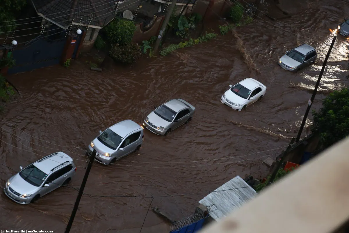
Kenya's Deputy President Kithure Kindiki has warned residents in flood-prone areas of Nairobi of possible temporary evacuations to designated holding grounds if heavy rains pose a direct threat to their safety and property. He made the announcement during a multi-agency disaster preparedness meeting in Karen, Nairobi, on Thursday, September 24, 2026. Kindiki confirmed that national and county security teams have established contingency plans ahead of the projected heavy rainfall.
According to Kindiki, weather projections indicate significant rainfall in Nairobi, which could lead to flooding, damage to roads and drainage systems, and disruptions to the electricity supply. The Deputy President stated that possible evacuation areas and temporary holding grounds have been identified, and food, non-food items, and medical supplies are being prepared for residents who may need to leave their homes. The coordinated intervention involves the Nairobi City County Government and national infrastructure agencies.
City authorities have mapped 227 flood hotspots across Nairobi's 17 sub-counties, with informal settlements and low-lying residential areas flagged for intense monitoring and potential emergency relocation support. These areas include Mukuru, Pipeline, Imara Daima, Kware, Kibera, Nyayo Highrise, Nairobi West, Madaraka, Lang'ata, and parts of Embakasi. To accommodate displaced households, 27 primary shelters and drop-off points, mainly public schools and civic facilities, have been designated.
Kindiki assured residents that those in high-risk areas will receive alerts and evacuation orders in good time if relocation becomes necessary. He called on residents to remain calm and cooperate with official evacuation directives. The Deputy President emphasized that both levels of government are taking proactive measures to safeguard lives and minimize economic disruption, despite acknowledged budget limitations.
Complementary preventive measures are being executed across related sectors. The Ministry of Health has activated response protocols across 18 high-risk counties, which include plans to distribute 10 million treated mosquito nets to prevent vector-borne disease surges. This move aims to mitigate the risk of disease outbreaks in the aftermath of the floods.
The State Department for Public Health has proposed a monthly national sanitation drive to mitigate waterborne illness risks. Additionally, field engineers have commenced structural inspections along key transmission corridors to minimize storm-induced power outages and guard against infrastructure vandalism during the rainy period. These measures aim to reduce the impact of the floods on the city's infrastructure and public health.
Kindiki's warning comes as Kenya prepares for the El Nino rains, which are expected to bring significant rainfall to the country. The government's proactive measures aim to reduce the risk of flooding and minimize the impact on residents. By identifying flood hotspots and designating evacuation areas, the government hopes to prevent loss of life and property.
Key points
- The Kenyan government has identified 227 flood hotspots across Nairobi's 17 sub-counties.
- Deputy President Kindiki has warned of possible forced evacuations in Nairobi's flood-prone areas.
- The government has designated 27 primary shelters and drop-off points for displaced households.