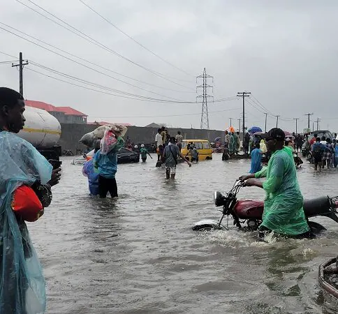
The National Flood Early Warning Systems Centre, under the Federal Ministry of Environment, has released a flood prediction warning communities across Nigeria of potential flooding. The alert covers 27 states and the Federal Capital Territory, with the forecast period spanning from September 27 to October 10, 2026. According to the advisory, affected areas may experience a combination of elevated soil moisture, rainfall, rapid surface runoff, drainage surcharge, and rising river levels.
The Centre has categorized affected communities into three risk levels: Critical Risk, High Risk, and Moderate Risk Watchlist. States with communities classified under the Critical Risk category include Benue, Kogi, Kwara, Niger, Adamawa, Bauchi, Taraba, Rivers, Edo, Delta, Cross River, Bayelsa, Akwa Ibom, Abia, Anambra, Ebonyi, Enugu, Imo, Ekiti, Lagos, Ogun, Ondo, Osun, and Oyo. In Ekiti State, listed areas include Ado-Ekiti, Ijero, Ikere, Ekiti Southwest, Ekiti East, Ise/Orun, and Ekiti West.
Lagos State has several communities on the critical-risk list, including Apapa, Badagry, Epe, Eti-Osa, Ikeja, Ikorodu, Ikoyi, Lagos Island, Lekki, Ojo, Orile Agege, Surulere, Agege, Alimosho, and Kosofe. The Federal Capital Territory is classified under the High-Risk category, with areas such as Abuja Municipal, Abaji, Asokoro, Bwari, Garki, Gwarinpa, Gwagwalada, Kuje, Kubwa, Maitama, Nyanya, and Wuse listed. Other states with communities under the High-Risk category include Nasarawa, Plateau, Bauchi, Taraba, Adamawa, and Kebbi.
The Centre has also placed communities in Bauchi, Borno, Gombe, Yobe, Zamfara, Sokoto, Katsina, Kano, Kaduna, and Jigawa on a Moderate Risk Watchlist. Residents in these areas are urged to remain prepared and monitor changing weather and drainage conditions. The National Flood Early Warning Systems Centre has advised communities classified as Critical Risk areas to maintain an immediate flood watch and verify evacuation routes.
The Centre has warned residents against settling, parking, trading, or storing goods within active floodplains, wetlands, riverbanks, and low-lying drainage corridors. For high-risk communities, the Centre called for intensified drainage clearance, monitoring of culverts and watercourses, and prompt reporting of rainfall, waterlogging, dam releases, and rising river levels. Residents in all affected areas are advised to comply with evacuation instructions issued by competent authorities.
The advisory also urges residents to keep children away from floodwater and avoid walking or driving through flowing water. Additionally, residents are advised to disconnect electricity where flooding is imminent and protect essential items, including medicines, important documents, food, and potable water. The Centre stresses that the predictions should be considered alongside real-time local observations, drainage conditions, river levels, and official emergency directives.
The National Flood Early Warning Systems Centre will use feedback from state governments, relevant stakeholders, and community focal persons to validate and update its predictions. The Centre's efforts aim to mitigate the impact of flooding on communities across Nigeria. Residents are urged to take necessary precautions to ensure their safety and the safety of their property.
Key points
- The Nigerian government has issued a flood alert for 27 states and the Federal Capital Territory, warning of possible flooding between September 27 and October 10, 2026.
- The National Flood Early Warning Systems Centre has categorized affected communities into three risk levels: Critical Risk, High Risk, and Moderate Risk Watchlist.
- Residents in affected areas are advised to take necessary precautions, including maintaining an immediate flood watch, verifying evacuation routes, and complying with evacuation instructions.