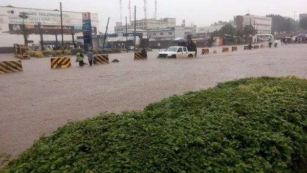
The El Niño weather phenomenon is expected to intensify ahead of its peak in December, with sea-surface temperatures in the central and eastern tropical Pacific projected to reach historic record levels. According to the World Meteorological Organization (WMO), this rapid strengthening will alter weather patterns worldwide, driving above-average temperatures and increasing the risk of severe floods and droughts. The WMO issued a global climate update on Thursday, October 8, 2026.
WMO Secretary-General Celeste Saulo stated that El Niño is developing into one of the most intense climate events in modern history. The phenomenon is firmly established and strengthening rapidly, with forecasts indicating a near-100 percent likelihood that it will persist through February 2027. This event could be one of the strongest since at least 1950, according to Saulo. The Niño 3.4 sea-surface temperature index surged from 1.6°C above average in June 2026 to 2.5°C in August.
Data compiled from 13 international climate research centers shows that the seasonal average for the October–December period is projected to hit 3.7°C above normal, surpassing the previous historic record of 2.6°C set during the 2015–2016 El Niño. The WMO warned that El Niño releases vast amounts of stored subsurface ocean heat into the atmosphere, driving extreme global weather. With baseline ocean temperatures currently at all-time highs, more thermal energy is available to fuel extreme weather events.
The Indian Ocean Dipole (IOD) is forecast to peak in October with a 0.5°C seasonal anomaly before tapering off, further influencing rainfall variability around the Indian Ocean basin. Additionally, elevated sea-surface temperatures across the equatorial Atlantic are expected to persist, interacting with Pacific climate drivers to shape broader regional weather patterns. These climate drivers will have significant impacts on global weather.
The WMO urged governments and disaster management agencies to prepare for widespread impacts on agriculture, infrastructure, and public health. Shifting rainfall patterns will increase vulnerable regions' exposure to flash floods and prolonged dry spells. As El Niño intensifies, it is essential for governments and agencies to take proactive measures to mitigate its effects.
El Niño's impacts will be felt globally, with some regions experiencing severe floods and others facing droughts. The WMO's warning highlights the need for preparedness and cooperation among governments, agencies, and communities to minimize the effects of this climate event. By working together, the impacts of El Niño can be mitigated.
The WMO's global climate update serves as a reminder of the importance of monitoring and understanding climate patterns. As El Niño continues to intensify, it is crucial to stay informed about its impacts and take necessary precautions to ensure public safety and minimize damage to infrastructure and agriculture. Key climate events like El Niño require coordinated global responses.
Key points
- El Niño is expected to reach historic record highs by December.
- The event could be one of the strongest since at least 1950.
- The WMO warned of increased risks of severe floods and droughts.