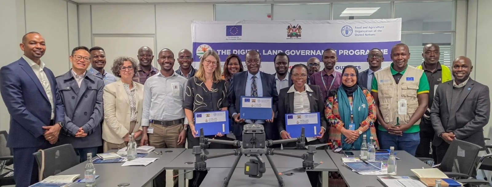
Vihiga County has taken possession of a drone aimed at enhancing geospatial planning and data-driven decision-making. The equipment was transferred through the EU-FAO Digital Land Governance Programme, which seeks to build geospatial capacity in counties and support accurate spatial data gathering. This initiative is expected to have far-reaching benefits, impacting not only Vihiga County but also the other 46 counties in Kenya.
The drone will support various activities, including agricultural and land-use planning, disaster preparedness, infrastructure development, environmental monitoring, natural resource management, and service delivery. According to FAO Country Representative in Kenya Farayi Zimudzi, the handover represents an investment in better data, planning, and decision-making for all 47 county governments. This move is anticipated to improve the overall planning and management of resources at the county level.
The EU-FAO Digital Land Governance Programme has made significant progress, equipping GIS laboratories in 39 counties and training over 241 technical officers. Additionally, the programme has established a network of more than 1,700 County GIS Departmental Champions. These efforts aim to enhance the capacity of county governments to collect, analyze, and utilize geospatial data for informed decision-making.
However, FAO cautioned that technology alone will not improve planning unless counties invest in personnel and systems to maintain and use the data generated. This highlights the need for counties to prioritize capacity building and infrastructure development to fully leverage the benefits of the drone and GIS systems.
The European Union noted that improved land information could attract investment by reducing uncertainty around land ownership and providing reliable land records. This is particularly significant, as access to accurate and reliable land information is crucial for economic development and investment.
Vihiga Governor Wilber Ottichilo emphasized that the county has already used its GIS system for planning and intends to extend the drone's benefits beyond Vihiga. The governor plans to train specialists to support the other 46 counties, highlighting the potential for collaboration and knowledge sharing among counties.
Ottichilo also stressed that access to data confers power and highlighted the drone's role in disaster preparedness and climate-resilience monitoring, especially for extreme-weather risks. This underscores the importance of the drone in supporting counties to prepare for and respond to natural disasters and climate-related challenges.
Key points
- The drone will support agricultural and land-use planning, disaster preparedness, and infrastructure development across Kenya's 47 counties.
- The EU-FAO Digital Land Governance Programme has equipped GIS laboratories in 39 counties and trained over 241 technical officers.
- Improved land information can attract investment by reducing uncertainty around land ownership and providing reliable land records.