The Togolese government is taking steps to implement a United Nations resolution aimed at promoting the use of equal-area map projections. The resolution, adopted by the UN General Assembly on September 4, encourages governments, schools, and other organizations to use map projections that accurately represent the size of territories. Togo's Minister of Foreign Affairs, Robert Dussey, played a key role in championing the resolution on behalf of the African Union.
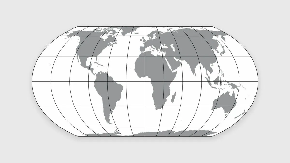
The implementation of the resolution will be supported by three renowned cartographers: Tom Patterson, Bernhard Jenny, and Bojan Šavrič. They are the creators of the Equal Earth projection, a map projection that represents the continents in their true proportions without distorting their shapes. The three experts have agreed to provide scientific and technical assistance to Togo's efforts to implement the UN resolution.
The Equal Earth projection was first published in August 2018 in the International Journal of Geographical Information Science. It has since been adopted by several prominent organizations, including the Goddard Institute for Space Studies at NASA and Esri, a leading geographic information systems software company. The African Union has also endorsed the projection as its institutional reference.
Togo will present a conceptual note in the coming weeks proposing the establishment of a scientific advisory group to support the implementation of the UN resolution. The group will comprise experts in the field of cartography, including Patterson, Jenny, and Šavrič, who will participate as individual experts. The advisory group will provide technical guidance on the use of equal-area map projections.
The UN resolution on map projections is not binding, but it encourages organizations to use projections that accurately represent the size of territories. This is particularly important for Africa, which has often been misrepresented on maps due to the use of projections that exaggerate its size relative to other continents. The use of equal-area projections can help to promote a more accurate understanding of the continent's geography.
The establishment of the scientific advisory group is a significant step towards implementing the UN resolution in Togo. The group will play a crucial role in providing technical expertise and guidance on the use of equal-area map projections. This will help to ensure that Togo and other African countries can effectively implement the resolution and promote a more accurate representation of their territories.
The initiative to establish a scientific advisory group on map projections is part of a broader effort to promote a more accurate understanding of Africa's geography. By working with international experts and organizations, Togo aims to contribute to a more nuanced understanding of the continent's place in the world. The use of equal-area map projections can help to promote greater awareness and appreciation of Africa's diversity and complexity.
Key points
- The Togolese government is establishing a scientific advisory group to support the implementation of a UN resolution on equal-area map projections.
- The group will be advised by three renowned cartographers: Tom Patterson, Bernhard Jenny, and Bojan Šavrič.
- The UN resolution encourages organizations to use map projections that accurately represent the size of territories.