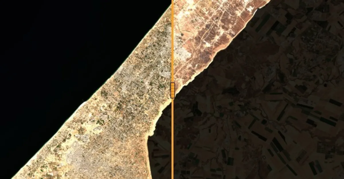
Satellite images taken over Gaza three years after the Israeli war reveal a landscape vastly different from the one that existed before the conflict. Prior to the war, Gaza appeared as a thriving urban area with tightly packed neighborhoods, clear roads, and agricultural areas surrounding residential areas. However, after three years of Israeli bombardment, the images show a sector that has lost its urban fabric, with many buildings destroyed, roads becoming more visible, and agricultural areas shrinking.
According to data published by the United Nations, nearly 82% of Gaza's structures, or around 201,290 buildings, had been damaged as of June 16, 2026. Of these, 134,422 were classified as destroyed, representing a 9% increase from the previous assessment in October 2025. The data, based on evaluations by the UN's Satellite Applications Catapult (UNOSAT), highlights the ongoing nature of the destruction, with later images showing previously standing buildings or remnants of destroyed ones disappearing in newer images.
The city of Rafah in southern Gaza presents a striking example of this transformation. Once a densely populated urban area with residential neighborhoods, schools, and markets, Rafah became a destination for hundreds of thousands of displaced individuals fleeing other areas of the sector. Satellite images show the city's urban fabric disintegrating, with large areas of open land and rubble replacing previously intact neighborhoods.
In northern Gaza, areas such as Jabalia and Shijaiya suffered significant damage during the early stages of the war. More recent satellite images reveal that the situation has not remained static, with new changes evident in these areas between December 2024 and September 2026. These changes include the demolition of parts of previously damaged areas and the emergence of new military sites.
Agricultural land, a crucial component of Gaza's food production and local economy, has also suffered significantly. Data from the Food and Agriculture Organization (FAO) and UNOSAT indicates that around 27% of Gaza's agricultural land remained accessible as of June 24, 2026. However, only 3% of the total agricultural area was reported as undamaged and accessible. This represents a 25.5% decrease compared to October 2025.
The coastal area of Al-Mawasi illustrates another aspect of Gaza's transformation, with land previously used for agriculture and low-density residential areas now hosting large gatherings of displaced persons. Clusters of tents have become a prominent feature of the landscape, reflecting the new distribution of population and urban planning in the sector.
The destruction extends beyond residential areas, with Gaza's port, historically associated with fishing and economic activity, bearing direct evidence of the damage inflicted on the maritime sector. According to the FAO, the destruction of fishing boats and port infrastructure has severely impacted an industry that provided a source of livelihood and food for thousands of residents.
Key points
- The estimated cost of recovery and reconstruction in Gaza is around $71.4 billion over ten years.
- Nearly 82% of Gaza's structures, or around 201,290 buildings, had been damaged as of June 16, 2026.
- Only 3% of Gaza's total agricultural area was reported as undamaged and accessible as of June 24, 2026.