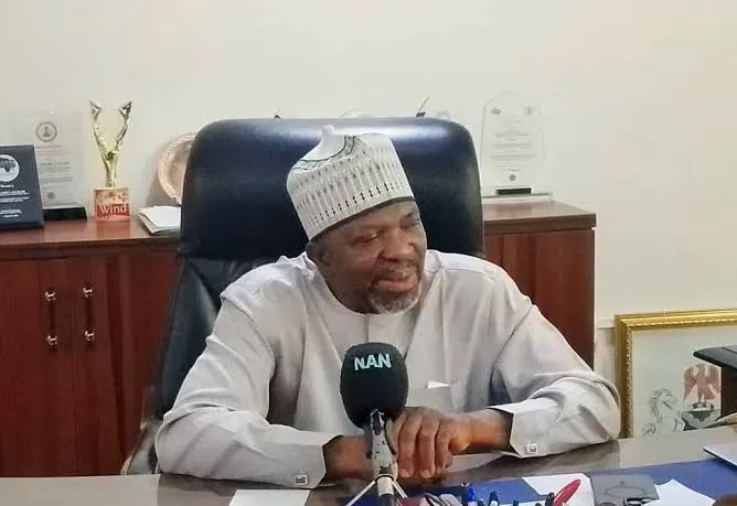
The Federal Government of Nigeria is bolstering border surveillance through the deployment of drones, satellite imagery, and other technologies to effectively monitor difficult terrains and enhance territorial management. This move was disclosed by the Director-General of the National Boundary Commission (NBC), Adamu Adaji, in an interview with the News Agency of Nigeria (NAN) in Abuja. Adaji emphasized the importance of technology in border management, particularly in areas that are challenging for personnel to access.
According to Adaji, drones can provide high-resolution imagery of border corridors and generate valuable information for planning, monitoring, and boundary management. He noted that unmanned aerial vehicles can access areas that are inaccessible or difficult for humans to reach, making them a crucial tool in providing necessary data for border management. The use of satellite equipment and other technological tools will also enable authorities to gather information from vast areas and monitor developments.
Effective border management, Adaji said, requires not only technology but also surveillance systems, cameras, and other means of gathering information and data. He stressed that Nigeria's extensive land boundaries with neighboring countries, including areas without adequate manning, necessitate the use of technology. The NBC boss, however, cautioned that technology alone cannot resolve border-management challenges without cooperation among relevant agencies and neighboring countries.
The NBC's primary responsibility, Adaji explained, is defining Nigeria's territorial limits, enabling other agencies to understand where their jurisdictions begin and end. He also highlighted the crucial role of border communities in supporting surveillance and reporting suspicious activities to relevant authorities. Adaji emphasized that providing necessary infrastructure to border communities would encourage their participation and strengthen their sense of belonging.
Adaji revealed that the boundary disputes between Edo and Kogi states remain unresolved due to vanished landmarks, competing claims, and community resistance. He stated that technical and administrative efforts had produced an approved boundary line, but implementation faced resistance from communities along the corridor. The NBC boss also mentioned that progress had been made on the Abia-Anambra boundary, with 15 kilometers of the 23-kilometer stretch already agreed upon.
The Edo-Kogi boundary was defined under Legal Notice No. 126 of 1954, which established the boundary between the Northern and Western regions. However, some physical features referenced in the document have disappeared over time, making it challenging for experts to accurately trace the boundary. Adaji said technical experts had attempted to interpret historical documents, but the disappearance of landmarks introduced subjective judgment into determining the boundary.
The NBC is addressing farmland disputes between Ibaji communities in Kogi and Uloshi/Esan South-East in Edo, alongside the broader interstate demarcation. Adaji assured that the commission would continue to work with state and local government boundary committees to obtain information and coordinate activities along border areas. The commission's efforts aim to improve border management, and Adaji expressed optimism that with improved technology, community cooperation, and inter-agency coordination, Nigeria's borders would be more effectively managed.
Key points
- The Federal Government of Nigeria is deploying drones and satellite imagery to monitor difficult terrains and enhance territorial management.
- The National Boundary Commission is working to resolve boundary disputes between Edo and Kogi states.
- Effective border management requires cooperation among relevant agencies, neighboring countries, and border communities.