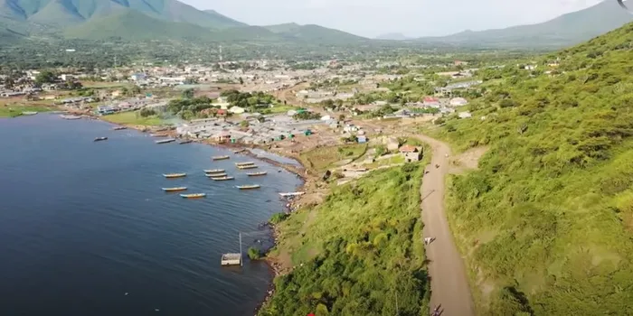
The Kenyan government's State Department for Agriculture has issued a call for consultants to undertake an integrated natural resources assessment across ten key counties. The project, part of the Integrated Natural Resources Management Programme (INReMP), aims to develop a monitoring framework for tracking deforestation, wetlands, riparian ecosystems, and groundwater potential. The assessment will cover baseline data in ten counties, including Kisumu, Kakamega, and Uasin Gishu.
The selected consultants will be responsible for preparing a Natural Resources Monitoring Framework, which will provide a system for tracking changes in natural resources. The framework will be developed using a combination of field surveys, geospatial analysis, and verification, and will include the creation of a spatial database to support management of the findings. The consultancy is budgeted for 120 days and will be financed by the International Fund for Agricultural Development (IFAD).
The ten counties targeted for the assessment are Kisumu, Kakamega, Kericho, Homa Bay, Migori, Nandi, Elgeyo-Marakwet, West Pokot, Trans Nzoia, and Uasin Gishu. The focus areas include the Cherangany Water Tower, Mau West Catchment, and the Lake Victoria Basin. The assessment will provide critical data on the status of natural resources in these areas, which will inform conservation and management efforts.
To qualify for the consultancy, firms must meet certain criteria, including holding a valid Kenya Revenue Authority tax compliance certificate, proof of registration, and at least ten years of continuous operation. Firms may form joint ventures or sub-consultancies to meet the qualification criteria. However, current government employees and client staff are barred from applying where conflicts of interest could arise.
The consultancy will involve a range of activities, including field surveys, geospatial analysis, and verification. The selected consultants will be required to submit a detailed proposal outlining their approach, methodology, and timelines for completing the assignment. The proposal will be evaluated based on the firm's technical expertise, experience, and capacity to undertake the assignment.
Interested firms are required to submit their expressions of interest by 11 am on 22 October. Submissions can be made in person at the INReMP office in Eldoret or by email. The State Department for Agriculture will review the submissions and select the successful consultants based on their qualifications and experience.
The natural resources mapping project is a critical initiative aimed at promoting sustainable management of natural resources in Kenya. The project will provide valuable data and insights that will inform conservation and management efforts, and contribute to the country's efforts to achieve sustainable development. The project is expected to have a positive impact on the environment and the communities that depend on these natural resources.
Key points
- The Kenyan government has launched a call for consultants to map groundwater, forests, and wetlands in ten counties.
- The consultancy is budgeted for 120 days and will be financed by the International Fund for Agricultural Development (IFAD).
- The assessment will cover baseline data across ten counties, focusing on the Cherangany Water Tower, Mau West Catchment, and the Lake Victoria Basin.