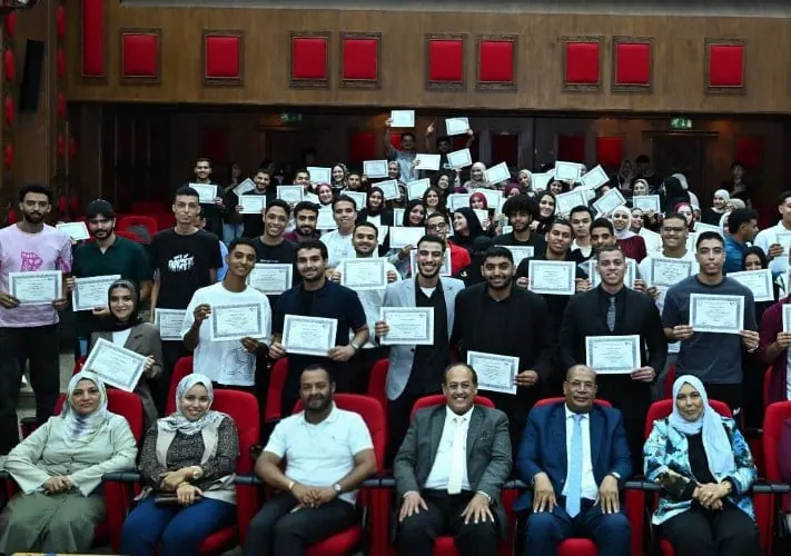
The Egyptian National Authority for Remote Sensing and Space Sciences recently hosted a scientific competition for students from the Geomatics program at Cairo University's Faculty of Arts. Nine student projects participated, focusing on practical applications in agriculture, environment, land management, natural resources, and urban planning. The competition was held under the auspices of Dr. Abdel Aziz Kansoua, Minister of Higher Education and Scientific Research and Acting Minister of Culture.
The competition aimed to develop students' skills and enhance the connection between education, scientific research, and labor market requirements. The National Authority for Remote Sensing and Space Sciences organized a field training program that allowed students to transition from academic knowledge to practical application. The program covered remote sensing technologies, geographic information systems, artificial intelligence, machine learning, cloud computing, and spatial data analysis.
Dr. Abdel Aziz Belal, head of the National Authority for Remote Sensing and Space Sciences, participated in the project discussions, along with Dr. Adly Anis Suleiman, coordinator of the Geomatics program at Cairo University's Faculty of Arts, and Dr. Ghada Ata, acting head of the Authority's Scientific Training and Continuous Studies Division. The competition reflected the Authority's focus on enhancing the applied aspect of student training.
The training programs offered by the Authority include specialized courses in remote sensing, geographic information systems, and artificial intelligence, as well as advanced applications such as geographic artificial intelligence, spatial data analysis using Python, and machine learning in remote sensing applications. The programs also cover topics like satellite image processing, deep learning, and big data analysis.
The competition saw each project group allocated 15 minutes to present and discuss their work, with 10 minutes for the presentation and 5 minutes for discussion. The event concluded with certificate awards to participants according to program regulations. The first-place project, "Classification of Agricultural Crops Using Machine Learning Techniques Based on Synthetic Aperture Radar (SAR) Images from the Sentinel-1 Satellite," was supervised by Dr. Mohamed Adham Fadl.
The second-place project, "Practical Training on Processing and Analyzing Point Clouds for Airborne and Terrestrial LiDAR Data and 3D Modeling Using ArcGIS Pro and Leica CYCLONE REGISTER 360 and TrueView," was trained by Dr. Asmaa Ahmed Mandouh. The third-place project, "Time Series Analysis of Land Cover Change Using Remote Sensing and Geographic Information Systems in Fayoum Governorate (1985-2026)," was supervised by Dr. Hagar Mahmoud Mohamed.
The competition results demonstrated a diversity of modern techniques used to serve applied issues. The winning projects utilized machine learning, radar data, LiDAR data, and cloud computing to address various challenges. These applications highlighted the potential for using geographic and spatial data to support planning, resource management, and monitoring of environmental, agricultural, and urban changes.
Key points
- The competition was part of the Authority's efforts to develop its training programs and provide specialized courses in remote sensing, geographic information systems, and artificial intelligence.
- The projects showcased the use of advanced technologies, including machine learning, cloud computing, and spatial data analysis, to address real-world challenges.
- The event aimed to enhance the connection between education, scientific research, and labor market requirements, and to prepare students for dealing with advanced technologies.